


Twin Cities SuperMap (Minneapolis-St Paul)
$ 8.99
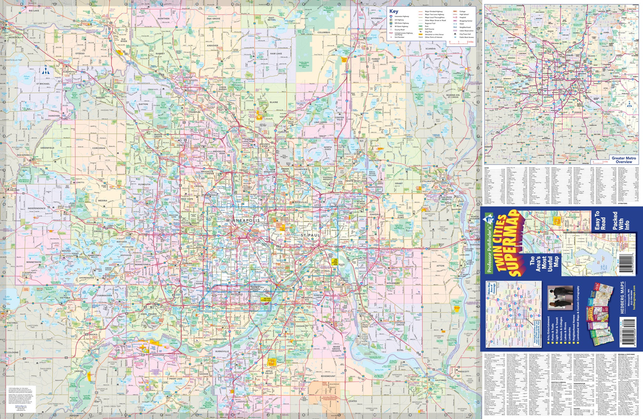
Our most popular map of the Mpls/St Paul area!
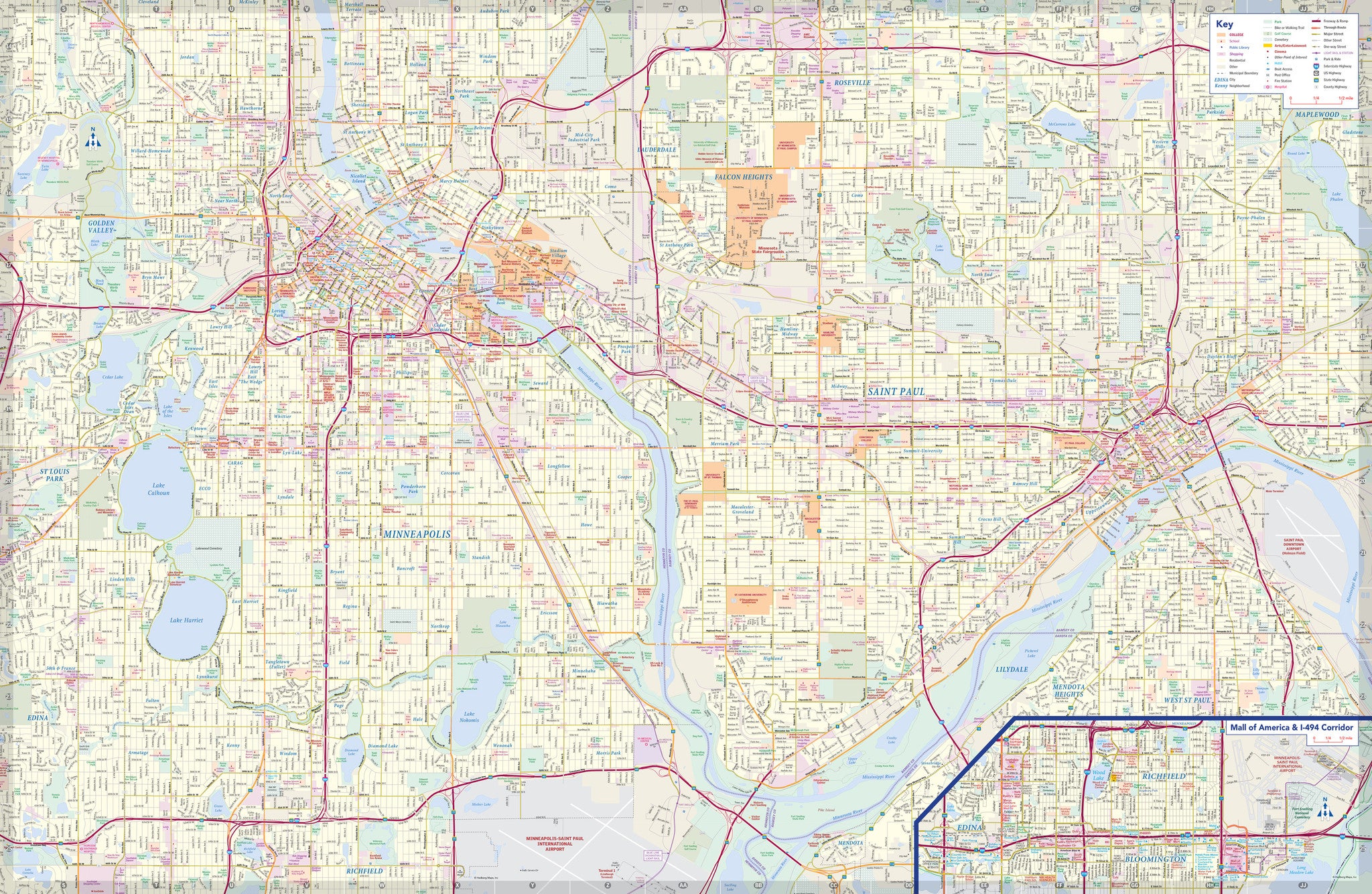
The Twin Cities SuperMap includes road network down to the county road level as well as numerous points of interest, such as, arts, entertainment and sports venues, schools, golf courses, parks, shopping malls, and so much more! The other side is a residential street map of core Minneapolis and St Paul with neighborhoods labeled. This is our most popular map for navigating the Twin Cities Metro!
Format: Folded Paper Map
Year Published: folded 2022 / flat paper 2017 edition
Unfolded Size: 38.5"w x 25"h
Folded Size: 4.25"w x 9.625"h
image shown is not current, but similar layout and area of coverage.
Also available as a 2-sided flat laminated map: identical information as folded map or one-sided WALL MAPS that come in multiple larger sizes available HERE.


